Blog

Stanage Edge Walk, Peak District: Parking, Route Options & What to Expect

Some links on Culinary Travels are affiliate links. This means I may earn a small commission at no extra cost to you if you choose to book through them. I only recommend places and experiences that genuinely fit the style and content of the site.
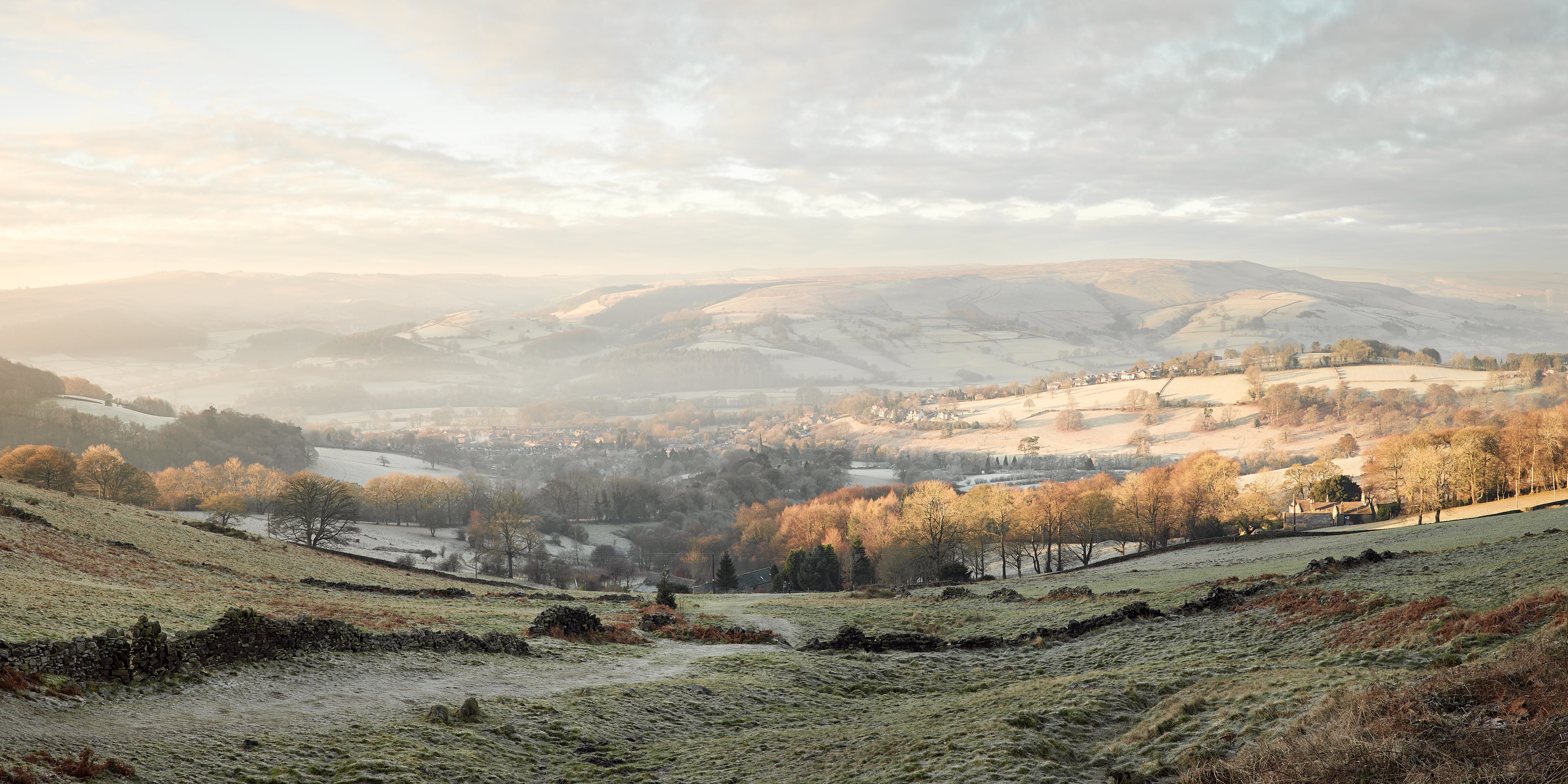
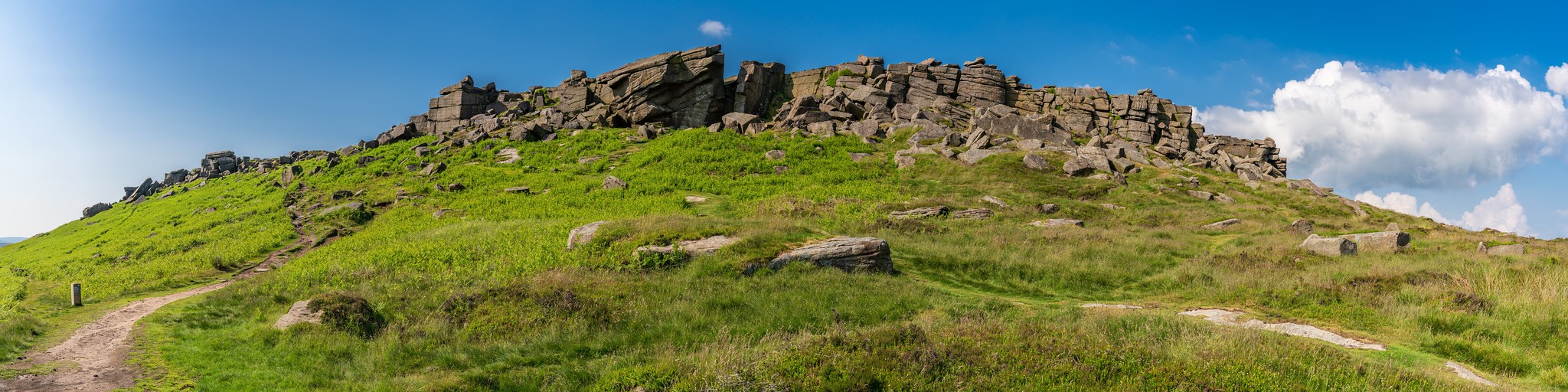
Stanage Edge is one of the most accessible and rewarding walks in the Peak District, a long gritstone ridge rising above Hathersage in Derbyshire on the western edge of Sheffield. Known for its sweeping views, open moorland, and dramatic rock formations, it’s a walk that suits both casual visitors and experienced hikers — you can enjoy a short scenic stroll along the edge or extend it into a longer circular route across the Dark Peak.
From rolling moorlands to dramatic gritstone escarpments, the UK is rich with landscapes that quietly demand your attention, and Stanage Edge remains one of its most compelling. Rising above the Dark Peak, this windswept ridge offers big-sky views and that particular Derbyshire quality where nature feels both elemental and deeply familiar, much like many of Britain’s other UK countryside destinations.
Approaching from Hathersage, the first glimpse of the edge is striking: ridges of weathered stone jut from the heather, sometimes sunlit, sometimes lost to moorland mist. Even before you set foot on the trail, the scale of the landscape becomes clear — this is a place defined by open space rather than summits.
Stretching for miles, the northern section forms a natural boundary between the High Peak and Sheffield in South Yorkshire. Walkers, climbers, and photographers have been drawn here for generations, not for a single viewpoint but for the experience of moving through a landscape shaped as much by geology and weather as by human history.

How to Get to Stanage Edge & Where to Park
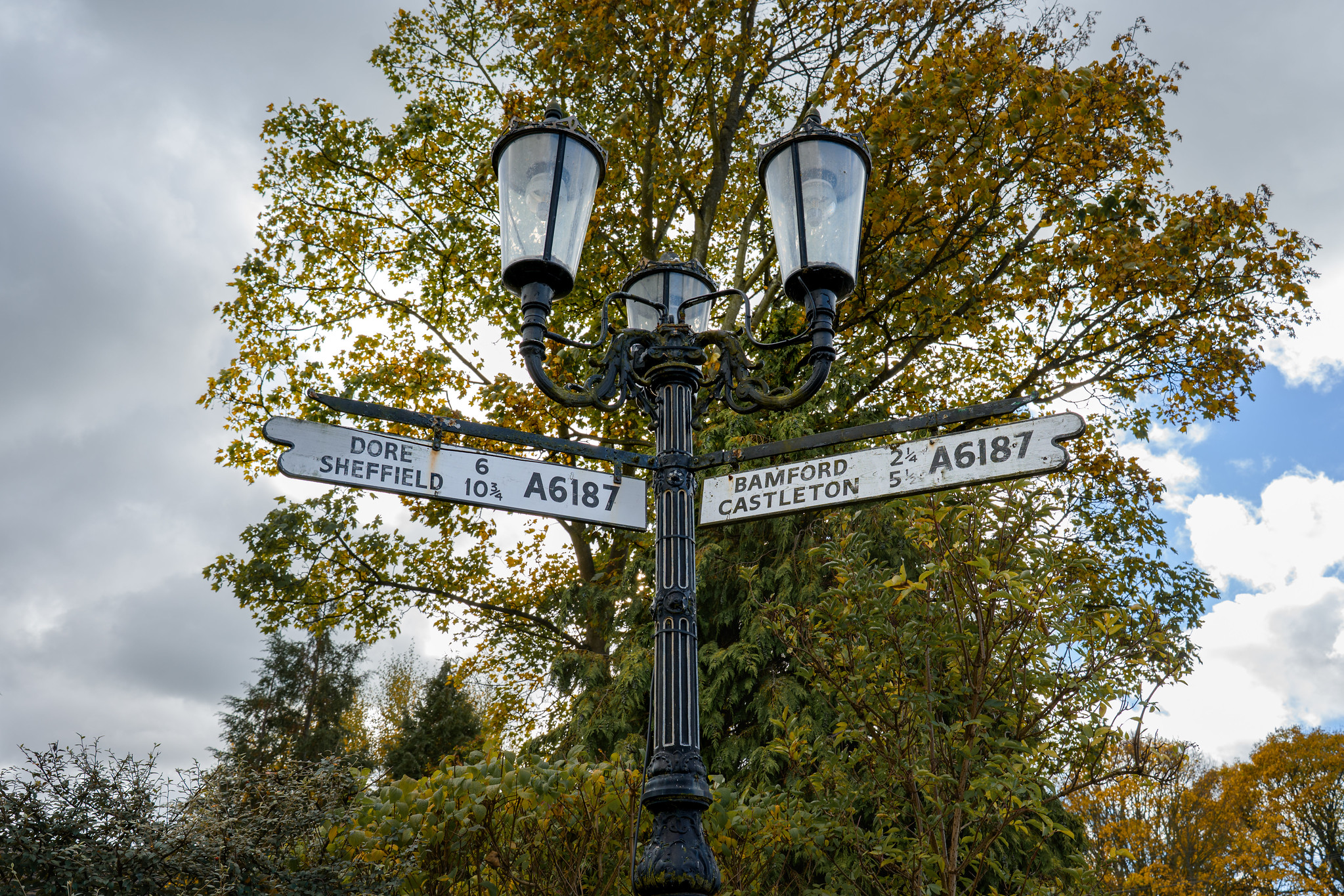
Stanage Edge sits just above the village of Hathersage in the Peak District National Park, around 25 minutes from Sheffield and about an hour from Manchester, making it an easy stop when planning a UK road trip through northern England. The ridge stretches for several miles, but most visitors approach from the southern end along the A6187, the road that runs between Hathersage and the Upper Derwent Valley. For visitors arriving in the UK for a trip, Manchester Airport is the closest major gateway before continuing into the national park.
The most commonly used access point is the roadside parking along the A6187, often referred to as Hook’s Car Park or the Dennis Knoll lay-by. It isn’t a formal car park — simply a long moorland pull-in — and on clear weekends it fills quickly. Arriving before mid-morning or later in the afternoon usually means a far easier time finding space. Postcode for navigation: S32 1BR (this brings you to Hathersage; continue uphill toward Stanage Edge).
Parking is also available within Hathersage village, which has public toilets, cafés and small shops. From here, well-marked public footpaths climb gradually onto the moor, creating a longer but gentler approach to the ridge.
Public transport is straightforward. Hathersage station sits on the Manchester–Sheffield line, and from the station it’s roughly a 30–40 minute uphill walk to reach the edge. Buses also connect the village with surrounding Peak District towns.
Whichever route you choose, the approach shapes the experience. Leaving the village behind, fields give way to open moorland and the first gritstone outcrops appear among the heather. The ridge reveals itself gradually, and the moment you step onto the edge the landscape suddenly widens — valleys falling away to one side, Sheffield’s distant skyline to the other.
Route, Terrain & Difficulty
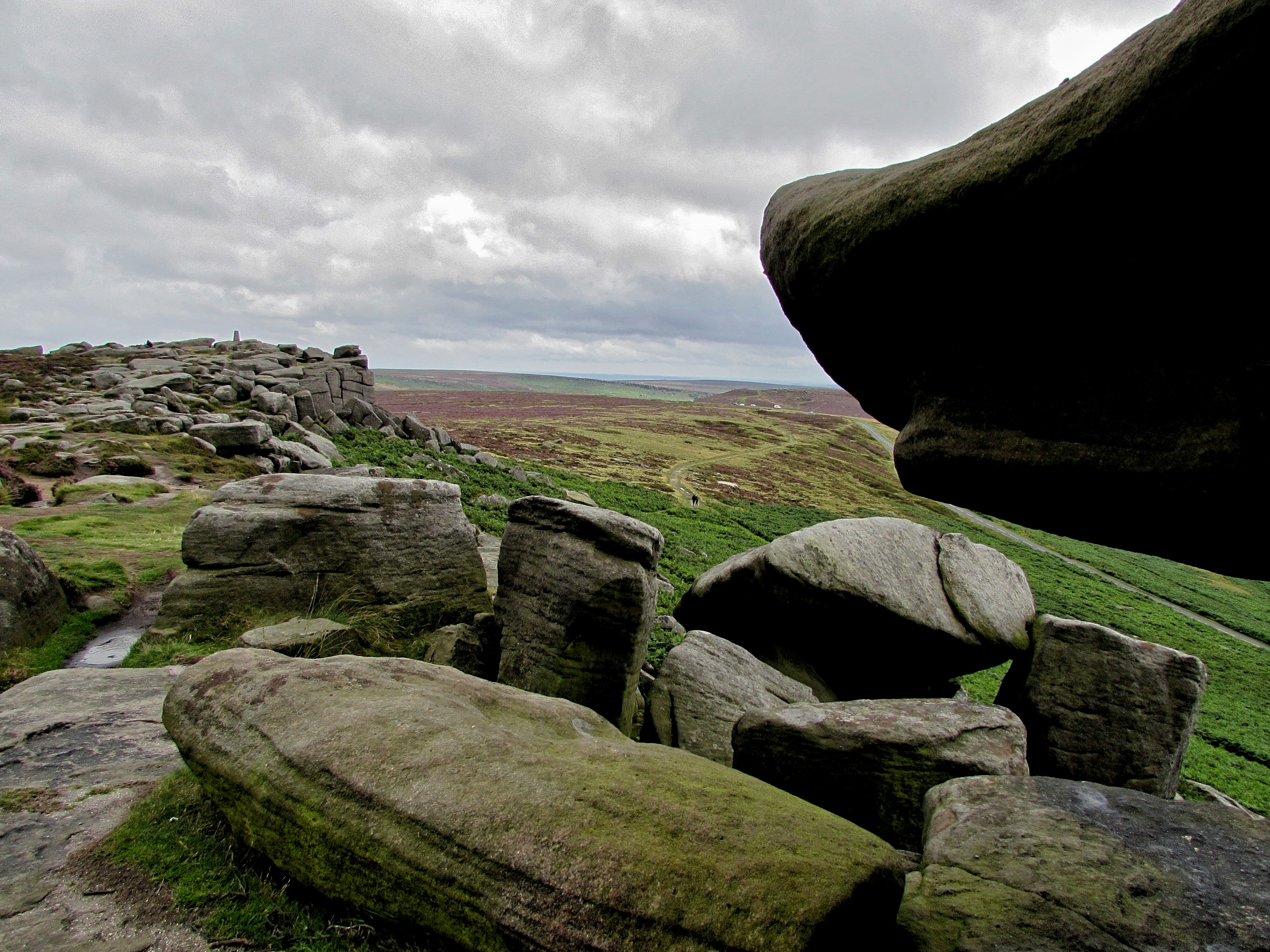
Stanage Edge is not a single defined trail but a long gritstone ridge with multiple entry points, which makes the walk very flexible. Most visitors follow the path running along the top of the escarpment itself, a relatively clear route across open access moorland. You can walk for as little as 20–30 minutes to reach a viewpoint or continue for several miles along the edge.
The terrain is uneven in places. Expect natural footpaths, exposed rock, heather, and occasional muddy sections after rain. Walking boots or sturdy shoes are strongly recommended, particularly in colder months when the moorland becomes waterlogged, and it’s worth checking what to pack for a hike before setting out. The ridge is also exposed to wind, and conditions can feel significantly colder than in the valley below.
Difficulty is best described as easy to moderate. There are no sustained steep climbs from the roadside approach, but the ground underfoot requires care and a reasonable level of mobility. Families with older children usually manage comfortably, while very young children may need supervision near the edge itself.
Pushchairs and wheelchairs are not suitable for most of the ridge, although short sections near the roadside parking area allow visitors with limited mobility to experience the views without committing to a full walk. Those seeking fully accessible Peak District paths may prefer the reservoir trails around Derwent Water and Ladybower, which offer level surfaced routes.
Because the ridge runs north–south, you can easily tailor the walk to your energy level and the weather. Many walkers simply wander along the edge for a while and turn back when ready, making it one of the most adaptable walks in the Peak District.

Walking Routes on Stanage Edge
Stanage Edge is best understood not as a single marked trail but as a long, accessible ridge. A clear path runs along the top of the escarpment, and most visitors simply join it from one of several approach paths and then walk as far as they like before turning back. Because of this, the walk can be very short or several miles long depending on time and energy.
The easiest introduction is from the roadside parking along the A6187. From here, a short uphill path leads onto the edge within minutes, giving wide views across the Hope Valley almost immediately. Many visitors walk south toward the Cowper Stone or north toward High Neb, the highest point on the ridge, before retracing their steps.
For a longer outing, walkers often begin in Hathersage and follow public footpaths uphill onto the moor, joining the ridge from below. This adds distance and a gradual climb, turning the visit into a half-day walk rather than a short viewpoint stroll.
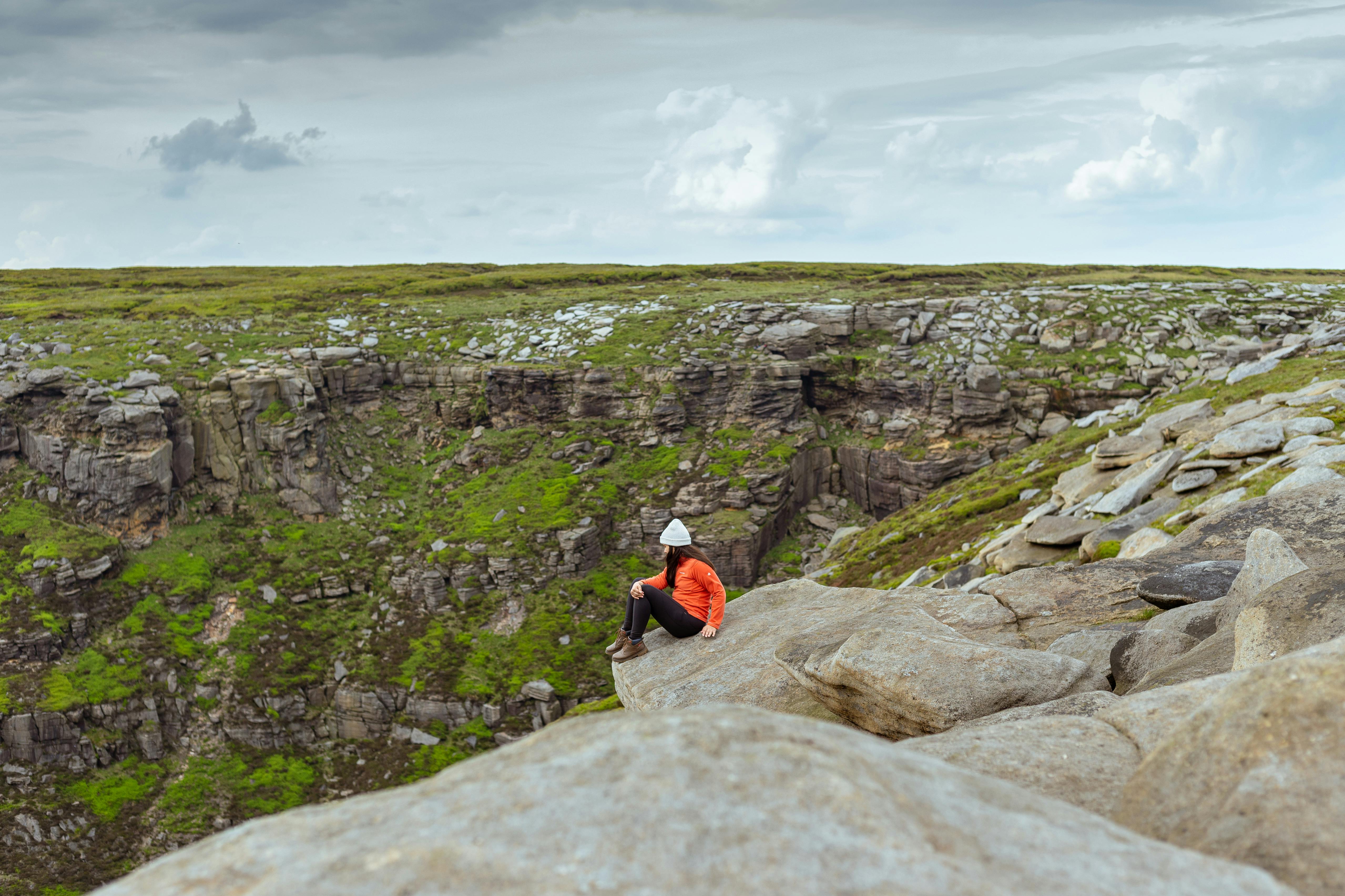
A popular extended route follows the escarpment between Burbage Edge and High Neb. This involves uneven ground and sections of rocky path but no technical climbing, just steady walking across open moorland. The reward is continuous panoramic views and a real sense of the scale of the Dark Peak landscape.
There are no signposted circular routes on the ridge itself, and in mist the open moorland can feel disorientating. A map or offline navigation is useful if you plan to walk further along the edge.
Stanage Edge walk length and time
From the roadside parking, most visitors reach the viewpoint in about 15–20 minutes.
A short out-and-back stroll along the ridge usually takes 1–2 hours.
Walking a longer section between Burbage Edge and High Neb is roughly 5–6 miles and typically takes 3–4 hours at a steady pace, longer with stops for photos or a picnic.
Best Time to Visit & Safety Tips
Stanage Edge can be visited at any time of year, but conditions on the ridge vary more than in the valley below. Late spring through early autumn usually offers the most comfortable walking weather, with longer daylight hours and clearer views across the Hope Valley.
Summer brings the easiest conditions underfoot and blooming heather in late August, although weekends can be busy and parking fills early. Early mornings and evenings are typically quieter and provide the best light for views and photography.
Autumn and winter are often calmer and less crowded, but the ridge becomes colder and wetter. After rain the ground can be muddy and gritstone surfaces slippery, while frost or ice occasionally forms in colder months. The edge is fully exposed to wind, and temperatures on the ridge can feel several degrees lower than in Hathersage.
Low cloud and mist can appear quickly and reduce visibility across the open moorland. If you plan to walk further along the ridge, carrying a map or offline navigation is sensible. Wearing sturdy footwear and bringing waterproof layers makes even short visits more comfortable.
Keep a safe distance from the escarpment edge and supervise children and dogs carefully. Let someone know your plans before setting out, particularly if visiting alone. With basic preparation, the walk remains straightforward for most visitors.
Stanage Edge is exposed year-round, so clothing matters more than distance walked. In summer, bring sun protection and light layers, as there is little shade on the ridge. Spring and autumn often mean wind and sudden showers, making a waterproof jacket and sturdy footwear advisable. Winter can be icy and significantly colder than the valley below, so insulated layers, gloves and boots with good grip are essential. Layering allows you to adjust quickly to changing conditions, and it’s wise to check the Met Office mountain forecast before setting out.
Because the ridge is fully exposed, clothing matters more than distance walked. Wind is often stronger on the edge than in the valley and there is little shelter. Layered clothing, a waterproof jacket and footwear with good grip are recommended in all seasons. Even on warm days carrying an extra layer is useful, as conditions can change quickly once on the moor.
For safety advice and preparation guidance, the Mountain Rescue England & Wales website provides practical information on walking in upland areas.
Many walkers also use the What3Words app, which provides a precise three-word location reference that can be shared with emergency services if needed. It can be helpful on open moorland where landmarks are limited, but always confirm your position carefully before sending it.
In an emergency in the UK, call 999 and ask for Mountain Rescue. Providing a location name such as “Stanage Edge near Hathersage” helps responders identify your position quickly.
What to Bring
Stanage Edge is an exposed moorland ridge with little shelter, so a small amount of preparation makes the walk far more comfortable. Sturdy footwear with good grip is recommended even for short visits, and carrying water and a snack is useful as there are no facilities on the ridge itself. In warmer weather sun protection helps, while at other times of year a waterproof layer and an extra jumper or fleece are worth bringing, as the wind can make the temperature feel much colder than in Hathersage below.
A phone or camera is useful for navigation and photos, and downloading an offline map before arriving can help if signal drops. Families may also find a small first-aid kit helpful for minor scrapes on rocky ground.

Visiting Stanage Edge with Children
Stanage Edge can work well as a family outing when planned as a short exploratory walk rather than a long hike. From the roadside access along the A6187 it takes only a few minutes to reach the ridge, allowing children to experience the views without covering a large distance.
The open moorland gives plenty of space to wander and explore, and many families simply walk a short way along the edge before turning back. Streams, heather and scattered rocks make the landscape interesting for younger visitors, while older children often enjoy spotting climbers on the crags below.
The terrain is uneven and there are steep drops from the escarpment, so close supervision is important near the edge and on rocky ground. Pushchairs are not suitable on the ridge, and sturdy footwear is recommended even for short visits.
Because the ridge is exposed, wind and temperature can change quickly. Extra layers, water and simple snacks make the outing far more comfortable, especially outside summer. Choosing a calm, clear day and keeping the walk flexible usually leads to the most enjoyable experience.
Many families combine a short visit to the edge with time in Hathersage afterwards, where cafés, open spaces and the village atmosphere provide an easier finish to the day.

Photography and Viewpoints
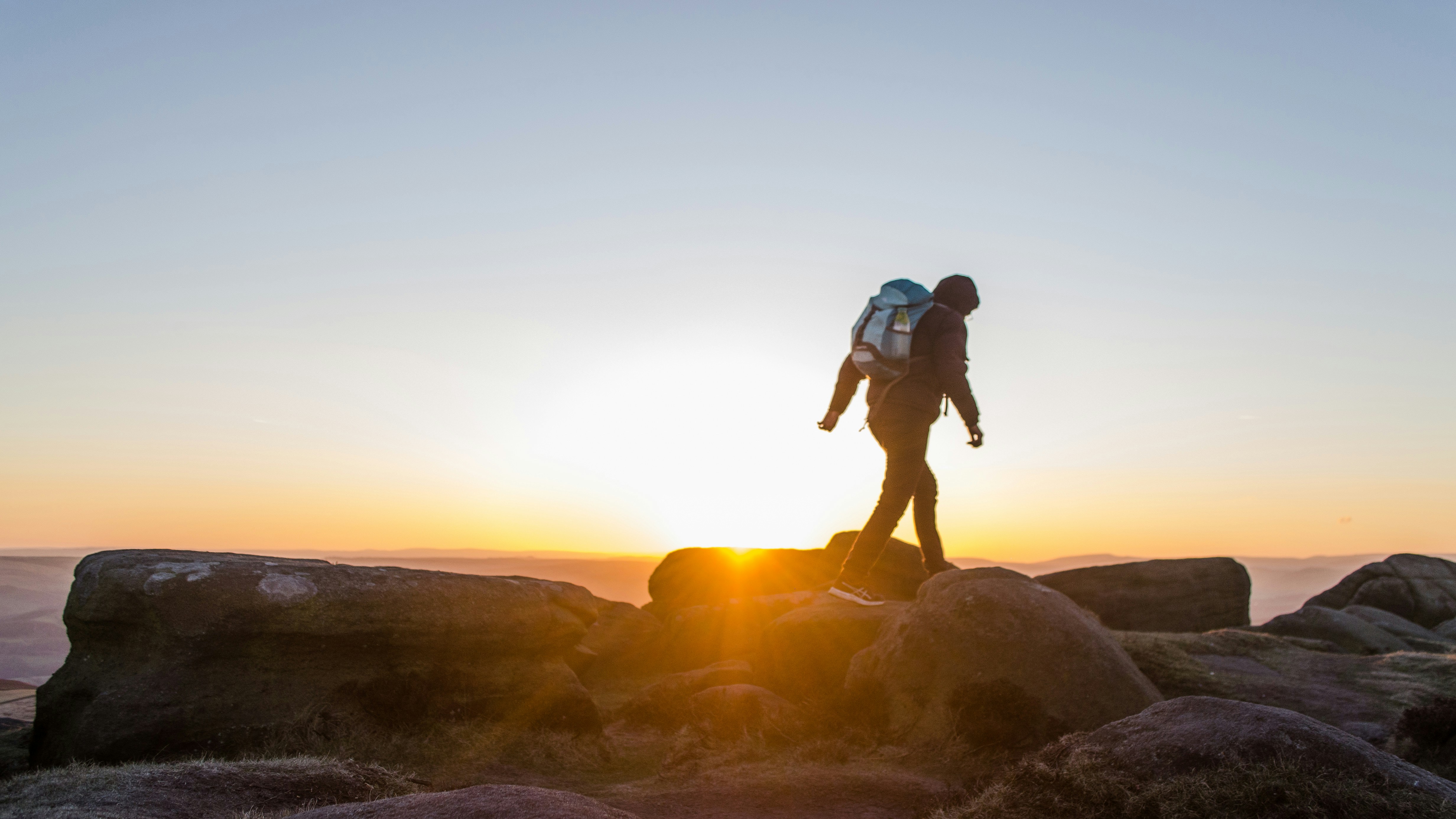
Stanage Edge is one of the most photogenic locations in the Peak District because the ridge runs roughly north to south. This means sunrise lights the Hope Valley to the east, while sunset illuminates the gritstone cliffs themselves from the west, giving two very different moods on the same day.
One of the best-known viewpoints is near High Neb, the highest point on the ridge, where the escarpment curves and opens wide views across the Dark Peak. The area around the Cowper Stone, a prominent rock formation along the edge, is another favourite for photographers and is especially striking in early morning mist.
Even a short walk from the roadside access brings strong compositions: layers of heather in the foreground, climbers on the rock faces below, and Sheffield’s skyline faint on the horizon in clear weather. Because the ridge is open and elevated, clouds and changing light alter the landscape constantly, making each visit look different.
Conditions change quickly on the moor. Wind is common and tripods need to be stable, but fast-moving clouds often create dramatic skies. Late afternoon and early evening usually provide the warmest light, while winter mornings sometimes bring frost or low cloud filling the valley below the edge.
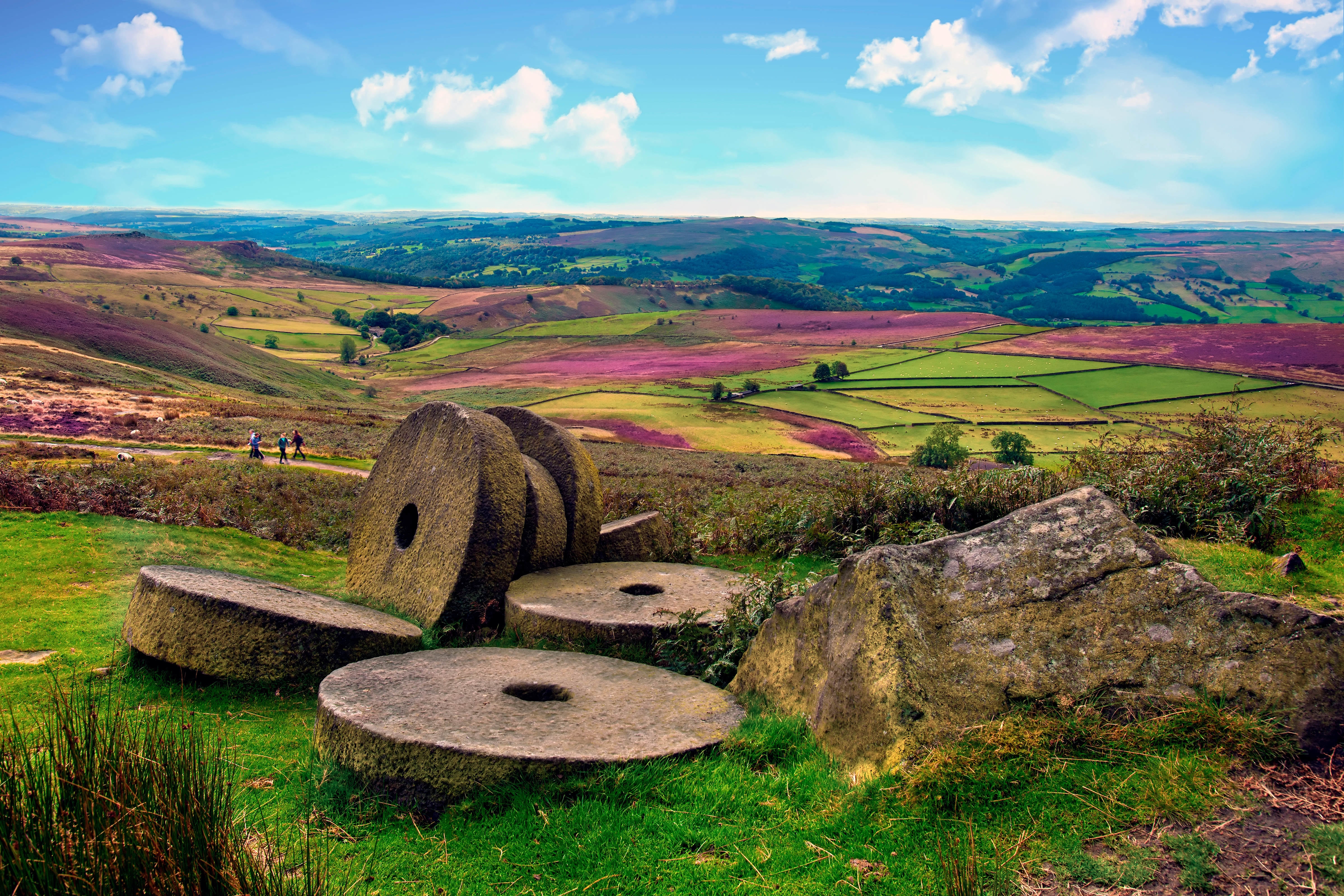
History on the Moor: Millstones and Landscape
As you walk along Stanage Edge you’ll notice large circular stones scattered across the hillside. These are abandoned millstones, left behind by 18th and 19th century quarry workers who cut gritstone here for grinding grain and sharpening tools. Some were rejected because of flaws in the rock, while others were simply never transported from the moor.
They remain where they were shaped, giving the ridge an unexpected industrial history beneath its wild appearance. The stones are particularly visible on the slopes below the edge and around the access paths from Hathersage.
Small streams, heather moorland and open grassland also support birdlife such as curlews and skylarks, whose calls often carry across the ridge. The open terrain makes it easy to wander slightly away from the main path, but the ground can be uneven and children should be supervised near rocky sections and drops.
Pausing at these quieter corners changes how the landscape feels. Stanage Edge is not untouched wilderness but a place shaped by both nature and people, where geology, industry and walking routes now overlap.

Wildlife and Moorland Landscape
Stanage Edge lies within upland heather moorland, a habitat characteristic of the Dark Peak. This landscape supports birdlife adapted to open, windswept ground. Skylarks are often heard before they are seen, rising high above the ridge in song, while kestrels hover along the escarpment searching for small mammals. Red grouse are sometimes spotted moving quickly through the heather, and sheep graze across the slopes throughout the year.
The plant life changes noticeably with the seasons. Late summer brings purple heather across the hillside, autumn turns the bracken bronze, and in winter the ridge becomes stark and open under frost or low cloud. Lichens and mosses cling to the gritstone, showing how slowly the rock weathers in the exposed conditions.
The open terrain makes wildlife easier to notice, particularly in the quieter early morning or evening hours. Keeping to established paths helps protect the fragile moorland surface. Visitors should follow the Countryside Code, particularly on open moorland where ground-nesting birds are present.

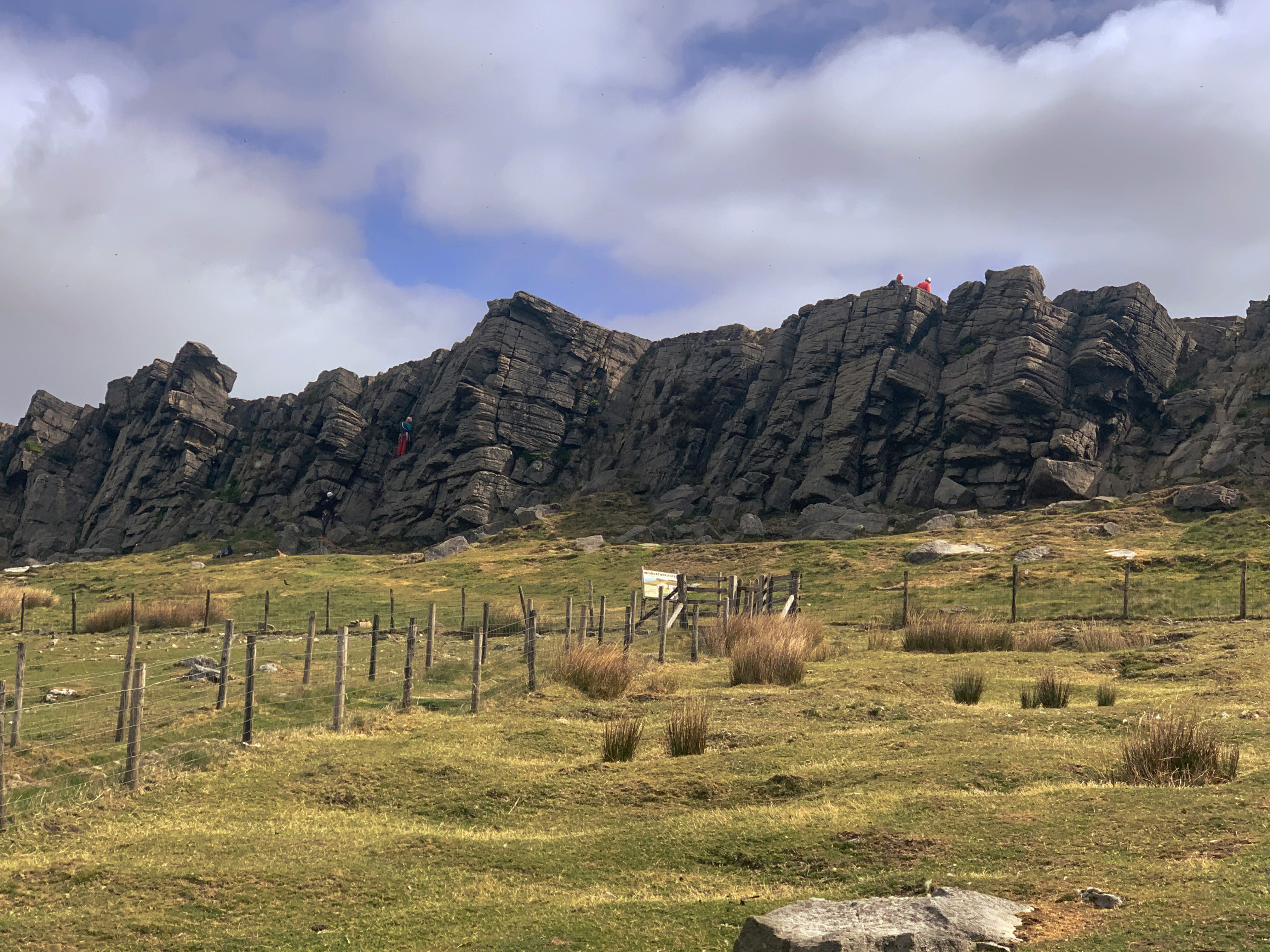
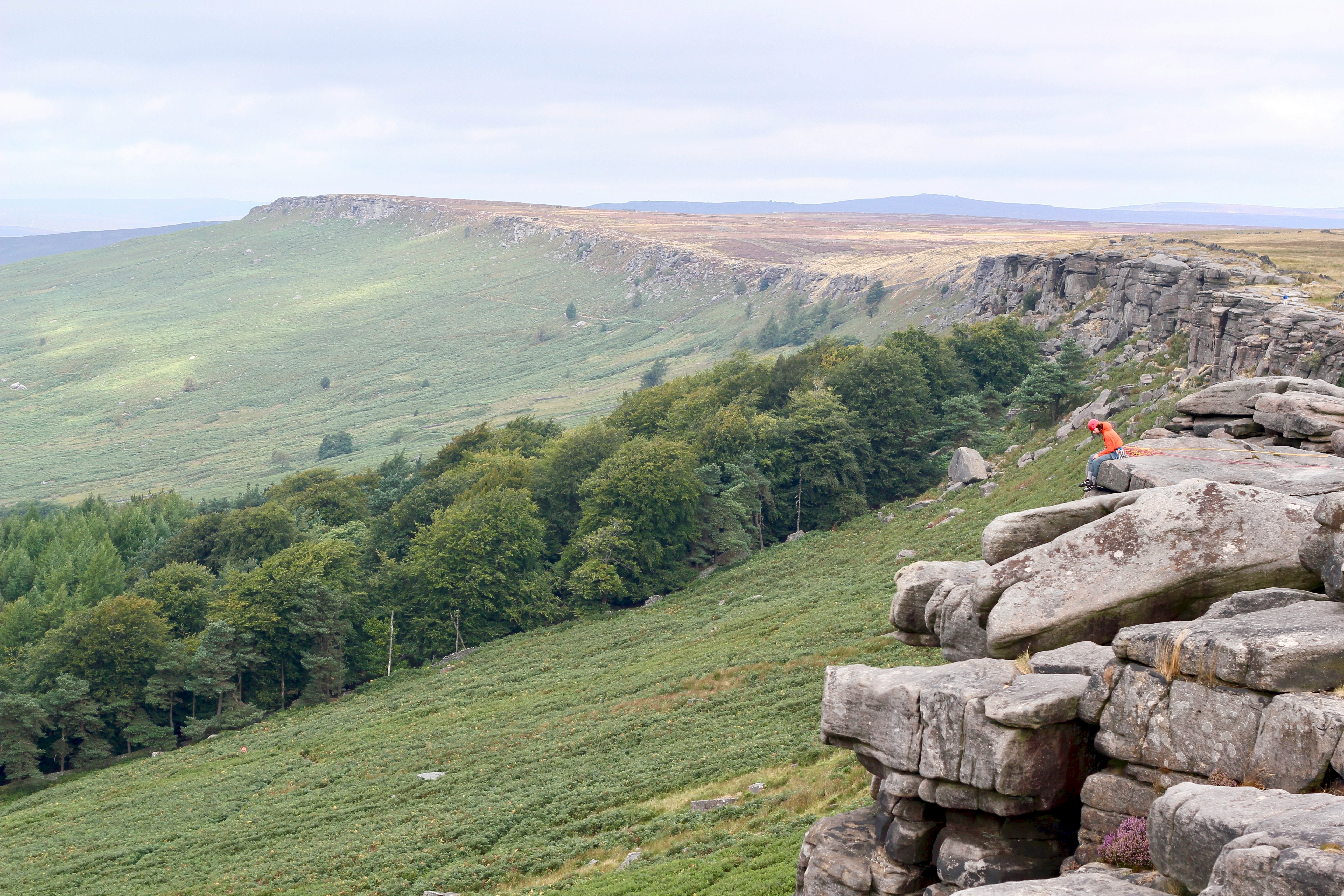
Climbing at Stanage Edge
Stanage Edge is internationally known within the climbing community and the gritstone crags below the main walking path are rarely empty on dry days. As you walk along the top of the escarpment you will often see climbers ascending the rock faces beneath you, their scale emphasising just how large the ridge really is.
The climbing routes here range from beginner practice climbs to highly technical ascents, and many British climbers learn outdoor techniques on this edge. For walkers, the presence of ropes and helmets becomes part of the landscape rather than something to participate in — the main path remains safely above the crag.
Anyone interested in trying climbing should do so with proper instruction through a qualified local guide or climbing school. The rock faces are steep and unprotected, and they are not suitable for casual scrambling without equipment or experience.
Even without climbing, watching the activity from the ridge adds another dimension to the visit. The contrast between slow, careful movement on the rock and the wide open moorland above gives a sense of both the scale and the character of Stanage Edge.
Things to Do Around Hathersage
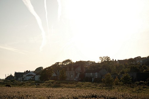
A walk along Stanage Edge pairs naturally with time in Hathersage, the nearest village and traditional starting point for many Peak District walkers. After the exposed moorland above, the village feels sheltered and lived-in, with cafés, bakeries and small outdoor shops clustered around the centre.
St Michael’s Church is often associated with local folklore linking the area to Robin Hood, and the churchyard contains a long stone grave traditionally said to belong to Little John. A short distance away, the open-air Hathersage swimming pool — one of the few heated outdoor pools in the country — is popular in warmer months and makes an unexpectedly good post-walk stop.
The surrounding Hope Valley also offers gentler walks along rivers and through fields, useful if the weather on the ridge turns windy or misty. Independent cafés and pubs in Hathersage and nearby Bamford provide reliable places to warm up after time on the moor, especially in colder seasons.
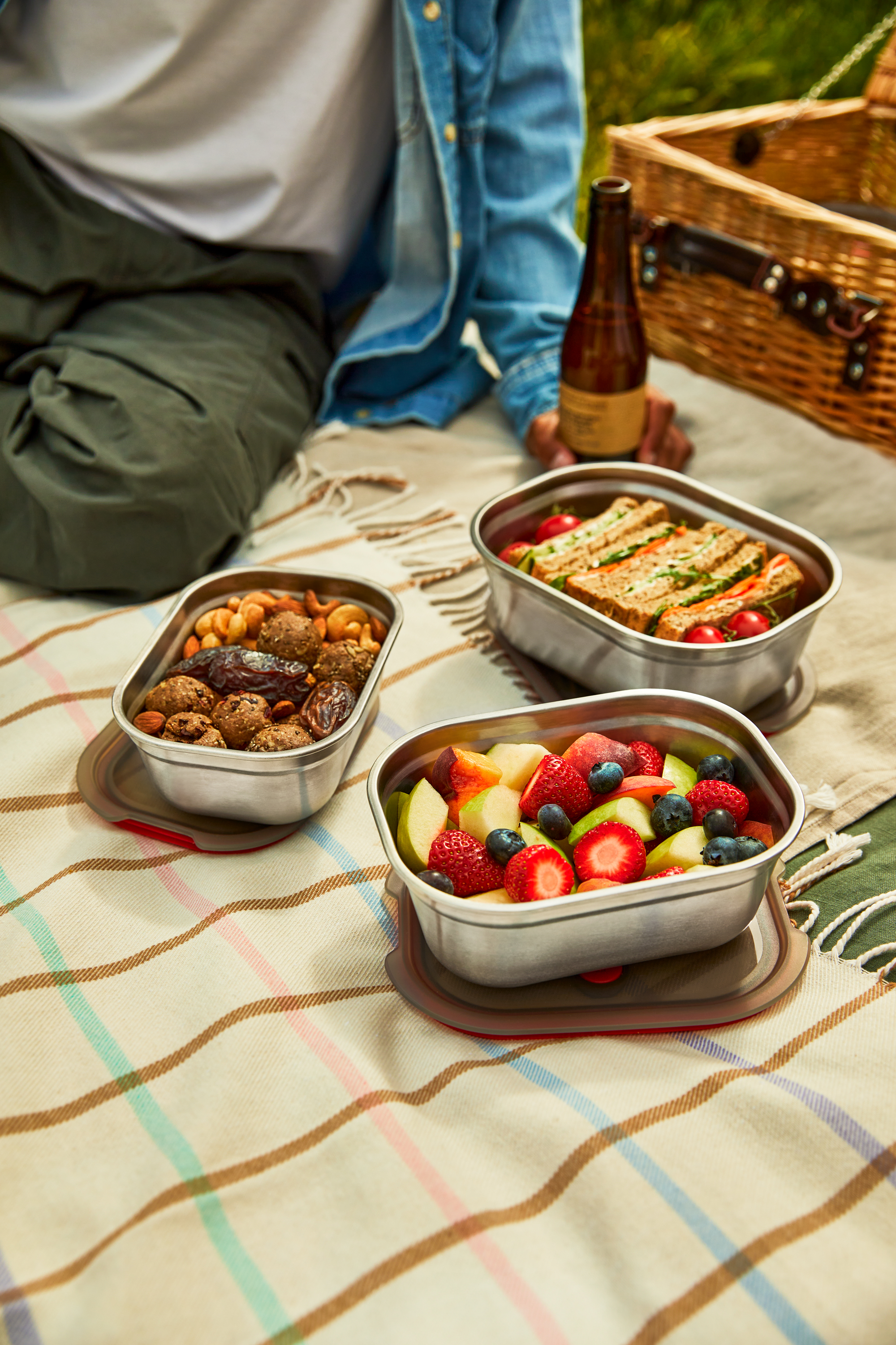
Farm shops and village stores in the area make it easy to assemble a picnic before heading up to the edge. On busy weekends many walkers combine a morning on the ridge with lunch in the valley, turning the outing into a relaxed full-day trip rather than a single short walk — or part of a wider set of other UK staycation ideas.
Where to Stay Near Stanage Edge
Most visitors base themselves in Hathersage, the nearest village to Stanage Edge and one of the most convenient locations in the Peak District for walkers. Staying locally means you can reach the ridge early in the morning or at sunset, when the light is at its best and the moorland is at its quietest.
The George Hathersage sits in the centre of the village and is an easy walk from cafés, pubs and the main approach roads toward the edge. Its location makes it particularly practical if you want to walk during the day and return on foot for dinner without needing to drive again.
The Little John Hotel, close to the train station, works well for visitors arriving by rail from Sheffield or Manchester. It’s also a good base for linking several Peak District walks together over a few days.
For a quieter stay overlooking the Hope Valley, Sladen Lodge offers rooms within walking distance of the access paths onto the moor, while Underleigh House in nearby Hope provides a small B&B alternative with easy road access to Stanage Edge and other Dark Peak routes.
If you prefer countryside surroundings, the Yorkshire Bridge Inn near Bamford places you close to both Stanage Edge and the Ladybower and Derwent reservoirs. Campers and budget travellers can also find bunkhouses and campsites nearby, including North Lees campsite beneath the ridge itself, which allows an early start onto the moor without needing to drive.
Choosing accommodation nearby changes the experience noticeably. Early mornings bring mist rising from the valleys and far fewer visitors on the ridge, while evenings often give the clearest views across the Dark Peak toward Sheffield.
Food and Picnics After the Walk
After time on the exposed ridge, most walkers head back into Hathersage, where cafés and bakeries make a natural second stop. A warm drink and something sweet quickly becomes part of the routine after a breezy walk across the moor.
For a simple option, many visitors pick up provisions in the village and bring them partway up the access paths to enjoy a short picnic with a view. The area is closely associated with traditional Derbyshire baking, and a slice of Bakewell tart makes a fitting post-walk treat after time on the hill.
Local pubs and cafés in Hathersage and nearby Bamford are also popular after a longer walk, particularly in colder months when the contrast between the exposed ridge and a warm interior is most noticeable. Combining the walk with lunch in the valley turns a short outing into a relaxed day in the Peak District.
Walk, Climb, and Step into a Story
In summer, sun-bleached heather and warm gritstone give Stanage Edge an almost literary atmosphere. The ridge stretches above the Hope Valley with a horizon that seems to run endlessly north and south, and it’s easy to see why this landscape has long inspired writers and storytellers. Nearby Hathersage is often linked with Charlotte Brontë’s visits to the area, and local tradition places the grave of Little John, companion of Robin Hood, in the village churchyard.
Walking here is less about reaching a summit and more about movement through space. Some visitors wander only a short distance from the access path to a viewpoint before turning back, while others follow the escarpment for miles, passing rock formations, climbers on the crags, and views opening across the Dark Peak toward Sheffield.
Climbing is part of the identity of the edge. The gritstone faces are internationally known within the climbing community, and on dry days it’s common to see ropes and helmets along the crag below the main walking path. Even for non-climbers, watching climbers move slowly across the rock adds a sense of scale to the landscape.
Dawn often brings still air and soft light across the moor, while sunset colours the stone deep gold. At these quieter hours the ridge feels at its most atmospheric, with fewer walkers and the wind carrying across the heather.
Stanage Edge doesn’t overwhelm with a single dramatic viewpoint. Instead, it gradually draws you in — a place defined by open space, weather, and time, where the experience comes from being in the landscape rather than simply looking at it.
Stanage Edge FAQ
How long is the Stanage Edge walk?
You can walk as little as 20–30 minutes from the roadside access to reach viewpoints, or continue for several miles along the ridge. A longer walk between Burbage Edge and High Neb can take 3–4 hours depending on pace.
Is Stanage Edge difficult?
The walk is generally easy to moderate. There are no sustained climbs from the main access points, but the ground is uneven and can be muddy or slippery after rain.
Is it suitable for children?
Yes for short, supervised visits. The ridge is exposed and has steep drops, so children should stay close to the main path and be carefully supervised.
Where do you park for Stanage Edge?
The most common parking is the roadside lay-by along the A6187 above Hathersage (postcode S32 1BR for navigation to the area). It fills quickly on weekends.
Is Stanage Edge safe?
In normal conditions it is a straightforward walk, but the ridge is exposed to wind, mist and cold temperatures. Wear suitable footwear, carry layers and keep a safe distance from the escarpment edge.
What should I bring?
Sturdy shoes, water, weather-appropriate clothing and a phone or map for navigation. There are no facilities on the ridge itself.
What should I do in an emergency?
Call 999 and ask for Mountain Rescue, giving your location as Stanage Edge near Hathersage.
Plan Your Visit
Stanage Edge is one of those places that feels larger once you’ve stood on it. The walk itself is simple — a path along a high gritstone ridge above Hathersage — yet the sense of space makes it memorable. Within minutes of leaving the roadside path the valley falls away, skylarks rise above the heather and the landscape opens in every direction.
You don’t need to complete the entire ridge to enjoy it. Many visitors walk only a short distance to a viewpoint before turning back, while others spend hours wandering along the escarpment. The experience changes with weather and light: clear days reveal wide views across the Hope Valley, while mist softens the moor into something quieter and more atmospheric.
With a little preparation and awareness of the conditions, Stanage Edge is an accessible introduction to the Peak District’s wilder landscapes. Whether you come for a brief stop, a longer walk, or simply to watch the changing sky from the ridge, it leaves a lasting impression not through a single landmark, but through the feeling of being high on open ground above the valley.
Prefer a guided experience? A few Peak District tours and activities are listed below.

Image credit: Some photographs on this page are used with permission from photographer Sebrina Evans. Additional images are licensed stock photography. This article was first published in May 2021 and updated in February 2026 to reflect current visitor information and walking guidance.
Stay in Touch
Culinary Travels publishes destination guides, seasonal recipes, and food-led travel features from the UK and beyond.
Follow for new articles and updated travel resources:
Facebook | Instagram | Pinterest
Newsletter
Receive new guides, recipes, and occasional travel planning notes by email: Subscribe here
Reader feedback and local recommendations are always welcome via the contact page.
©2026 Culinary Travels. Culinary Travels is written and edited by Georgina Ingham | Website designed by The Smarter Web Company
What Our Followers Say
"Oh yum!!! I could eat one or two right now!"
Sami Tamimi
"Georgina was great to work with, quick to respond, and is an excellent content writer - would highly recommend collaborating with her!"
Nick S, Get Blogged
Our list of things to do in Cork has just expanded hugely thanks to Culinary Travels.
Triskel Art Centre Cork